Badwater Basin is a unique and interesting place. There is no other place like it in the Western Hemisphere which is the reason why it has to be on your must-visit list to the Death Valley National Park.
Information about Badwater Basin:
- Location: Drive south on Badwater Road from Furnace Creek. Or drive north on Badwater Road from Ashford Junction.
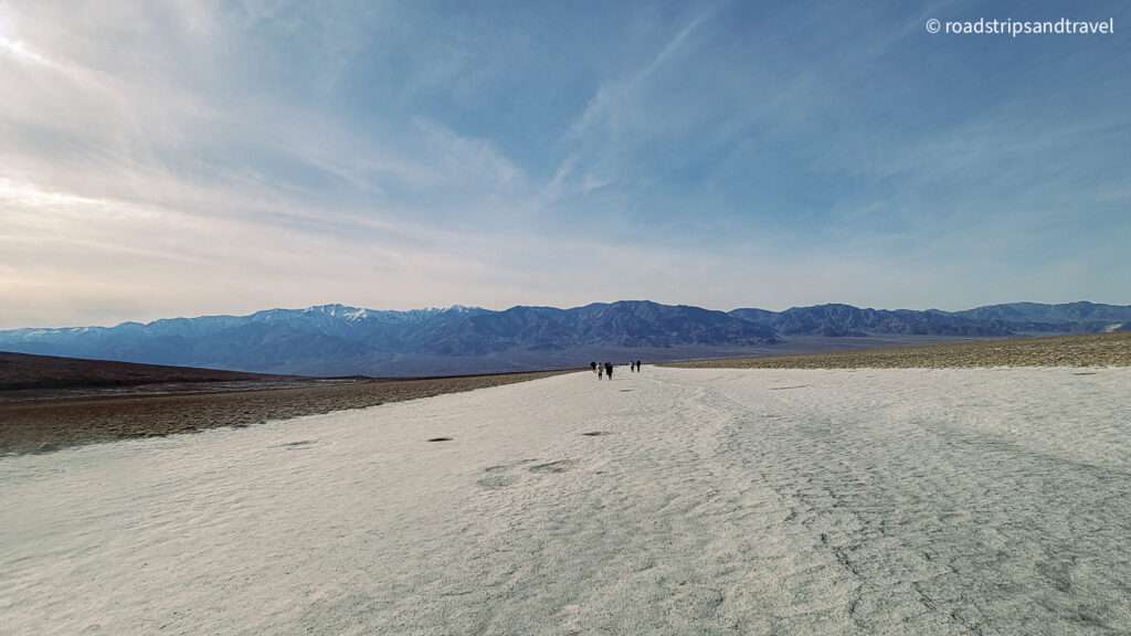
- Distance of Hike (Roundtrip): 2 miles (3.2 km) to the edge of Salt flats. Time needed to Hike (Roundtrip): 1.5 hours.
- Difficulty of Hike: Easy.
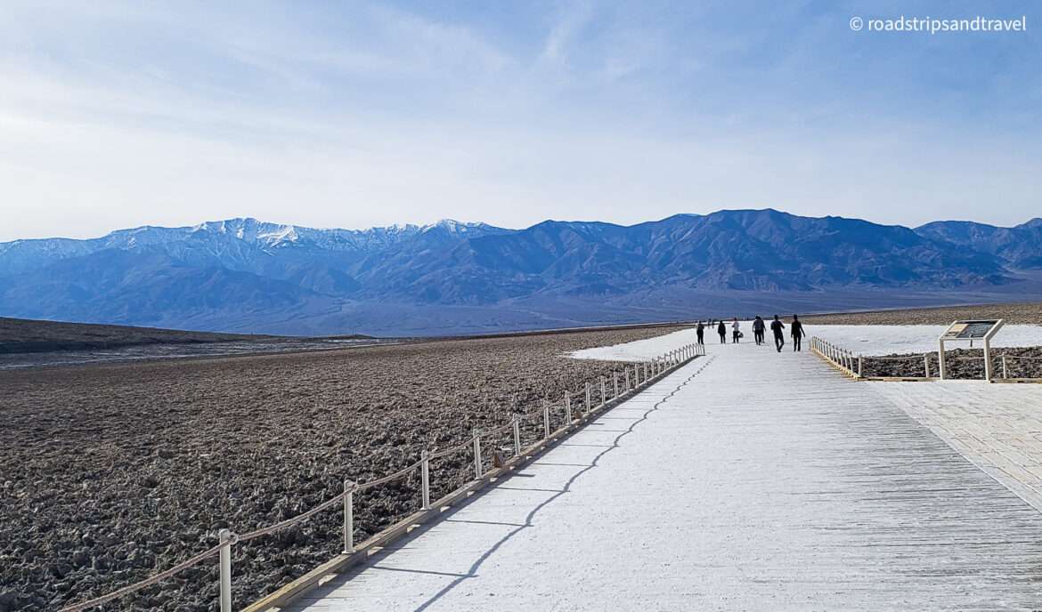
- Trail Type: Boardwalk initially, then route along out and back trail.
- Elevation Gain: None. This is the flattest trail you will ever encounter! 🙂
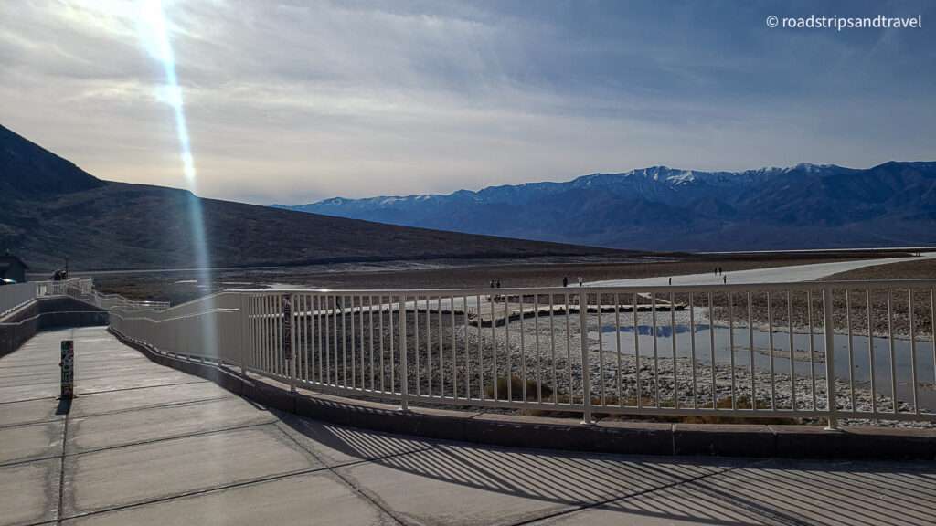
- Parking: Paved parking lot for cars, buses and large RVs.
- Closest Restroom: Vault toilets located in the parking lot.
- Route: An ADA accessible ramp leads down to a wooden boardwalk. The walking surface is firm and wide beyond the boardwalk.
- Pets: Pets are not allowed on any trail in Death Valley National Park.
- Official website: https://www.nps.gov/thingstodo/visit-badwater-basin.htm
- Fees/Online Tickets: https://www.nps.gov/deva/planyourvisit/fees.htm
Why visit Badwater Basin?
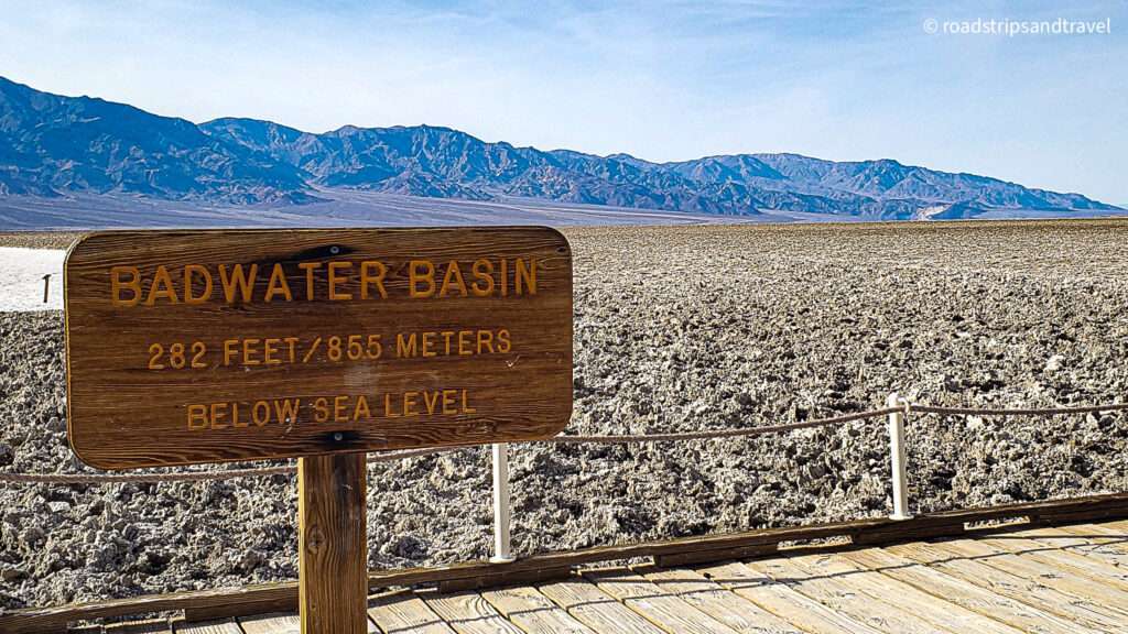
The best reason that I can think of for visiting the Badwater Basin is that it is a place of SUPERLATIVES! It is the LOWEST, DRIEST, HOTTEST place in the Western Hemisphere. It is the lowest at 282 ft (85.5m) below sea level. It is the driest because it receives less than 2 inches (5mm) of annual rainfall and hottest because temperatures here in summer can skyrocket to 134 F (56.7°C). Seriously, there is no other place like it in the Western Hemisphere, so Badwater Basin has got to be on your must-visit list to the Death Valley National Park.
Interesting Facts about Badwater Basin:
- Badwater Basin was once the site of the large ancient inland Lake, which evaporated hundreds of years ago.
- While Badwater Basin is the lowest point in North America, the next lowest point is also nearby. This is in the Salton Sea and is at -227 ft or -69m below sea level. The lowest point though goes to the Dead Sea in Jordan/Israel which is -1360ft or -414m below sea level.
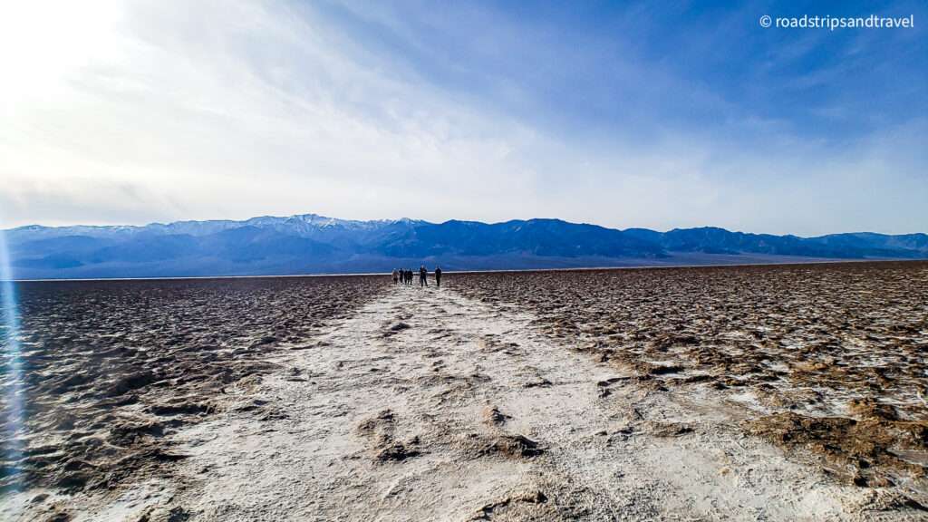
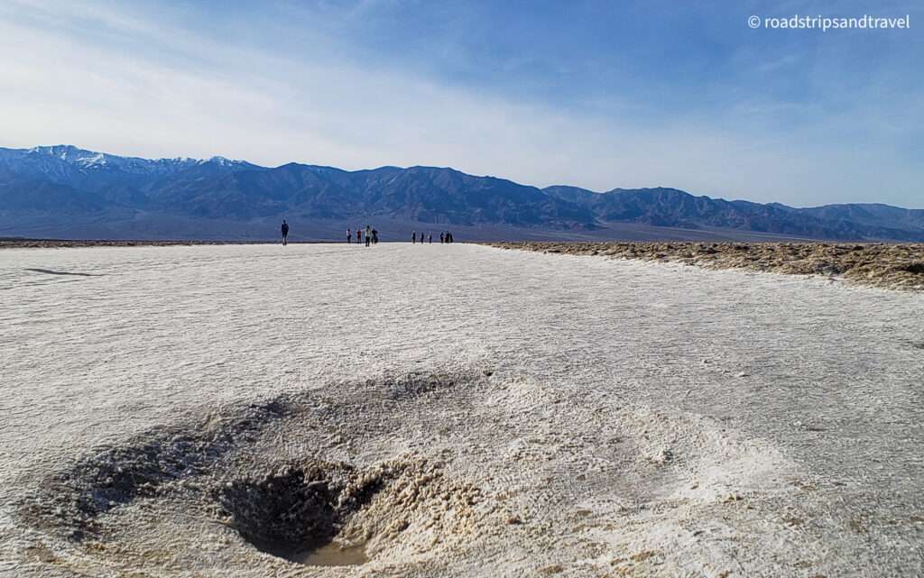
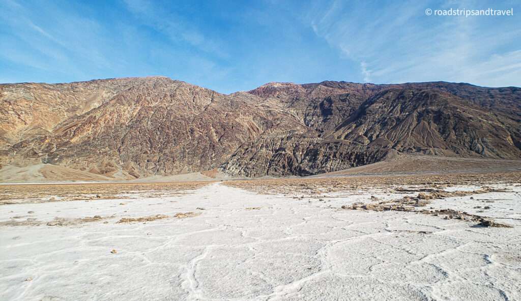
- The salt flats seen here are some of the largest in the world and contain unique polygon shapes.
- The salt flats are composed mostly of sodium chloride (NaCl – table salt), along with calcite, gypsum, and borax.
- The Panamint Range is to the west of Badwater basin and its highest peak is Telescope Peak which is at 11,049 ft (3, 368 m). This peak is over two miles (3.2 km) above Badwater basin. Nowhere else in America can you see such a contrast in Altitudes.
- Death Valley is unique and otherworldly. It is a one-of-a-kind location. To see something similar, you would have to travel to Bolivia or the Middle East.
Travel tips while hiking the Badwater Basin:
- The pool and boardwalk are easily accessible from the parking lot of Badwater Road, but the best views of the salt polygons require an easy 1.5-2 mile (2.4-3.2 km) roundtrip walk out onto the salt flats.
- Be sure to look up on the cliffs of the Black Mountains behind the parking lot and you will see a sign high above, indicating sea level.
- The overlook at Dante’s Peak has imposing views over Badwater basin and the surrounding desert. A visit to badwater basin is not complete unless you combine it with the Dante’s Peak overlook and take in the view from there.
- The best seasons to visit badwater basin are spring, fall and winter. Summers are scorchingly hot and it is not advisable to hike this place during peak summer.
- We visited in February and there were considerably less crowd and after hiking for about a mile, we had the salt flats to ourselves and saw perfect polygon shapes.
- When hiking anywhere in the Death Valley National park, always carry water, a protective hat and sunscreen.
- While hiking the salt flats, wear comfortable shoes with a strong grip. Due to the evaporating moisture, some places along the flats might be slippery.
- It is a good idea to download the Death Valley App because reception is spotty inside the valley.
Unique Geography:
Badwater basin is an endorheic basin. Basically, an endorheic basin does not allow any of its water to run to other external water bodies such as an ocean or a river, but instead drains water inward. This inward drainage converges into lakes or swamps which may be permanent or seasonal. Death Valley was not created by a river’s erosion but rather through movements in the earth’s crust which have dropped the basin to this great depth. Another unique geographic feature here are the fascinating and surreal geometric polygons called “salt flats”.
How are salt flats formed?
Two factors contribute to salt flat creation. Firstly, the extremely dry climate exposes the land below sea level. In wet climates, low places fill with water and overflow to the sea. A dry climate evaporates water, leaving behind salt flats or briny lakes. Second, since the lake had no outlet, this causes accumulation of sediment and salt over time. When the lake eventually evaporates, concentrated salt deposits in the form of “flats” are left behind. The salt flats here cover nearly 200 square miles (518 square km), making it one of the largest salt flats in the world.
Why is it called Badwater Basin?
During 1849, which was the time of the “Gold” rush, many prospective surveyors flocked to California in search of the precious metal. One legend states that Badwater Basin earned its name when a mule belonging to an early surveyor refused to drink from the spring-fed pool near the present-day boardwalk of badwater basin. The mule probably refused because the water here is very salty. The surveyor then named it badwater.
Wildlife & Vegetation:
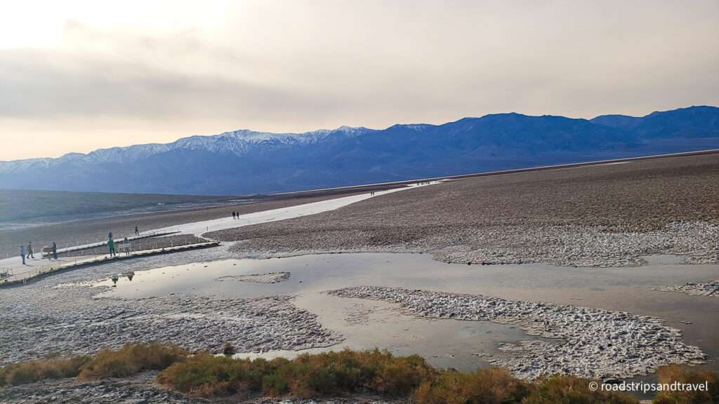
Despite the high salinity which gave rise to the name “badwater”, many organisms not only survive, but thrive here. The salt pools are home to an endemic snail naturally found only at this location called “Badwater snail”, and its rim is dotted with salt tolerant plants, including pickleweed. Badwater never dries out completely, and even manages to support a unique species of fish called the Death Valley pupfish, a small bluish creature which has adapted to these conditions.
Conclusion:
So in conclusion, I would say that our visit to Badwater Basin was delightful! This place is unique and otherworldly and easily one of my top 3 places to visit in the Death Valley National Park. While we were driving back from the badwater basin, we couldn’t help but marvel about this strange and isolated landscape which supported the early settlers who lived and worked here!
Comment and let us know what you think were the best features of the badwater basin!
Leave a Reply